


Fig.1: Ground measurements on sled Greenland 1997.

Fig.2: Ground measurements in Antarctica.

Fig.3: Helicopter measurements: instrumentation.

Fig.4: Helicopter measurements: Bygol-1.
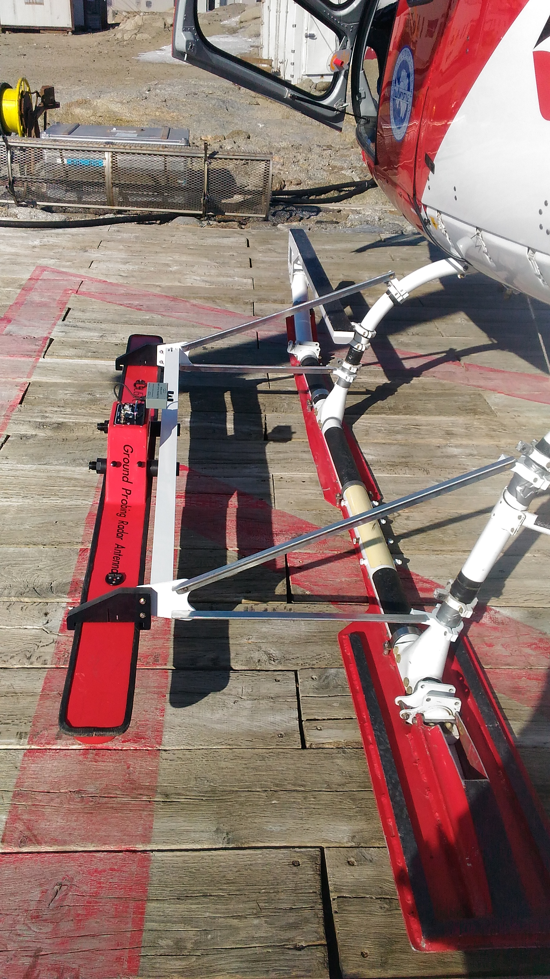
Fig.5: Helicopter measurements: antenna arrangement.
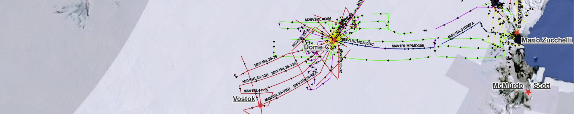
Radar exploration even over large areas is the basis of glaciology and plays different roles in the study of glaciers to determine their thickness and volume, the internal stratification of the ice, the first layers of snow (firn), the topography of the bedrock, including the characterization of crevassed areas. The method, widely used with full success in the polar areas, encounters greater difficulties when applied to the detection of mountain glaciers such as the Alpine and Himalayan ones. These difficulties are due to the different physical characteristics of temperate ice and to the logistical technical problems associated with carrying out field operations at high altitude on areas where there are crevasses, seracs and ice falls, making the glacier surface extremely varied. Depending on the ice conditions, the orography of the areas and its extension, different measurement techniques are used with different means of investigation.
Ground measurements : Ground measurements are used to carry out detailed surveys in areas of particular interest such as drilling sites or small glaciers. The instrumentation is placed inside suitable mechanical means such as snowmobiles (ski-doo) or snow cats (fig. 2), the antennas are mounted on sledges (fig. 1) and towed along the chosen survey paths.
Helicopter measurements : Helicopter measurements are carried out in non-extensive areas and in remote places that are not easily accessible by land or inaccessible means and for this reason they are easily used in the study of Alpine glaciers and in areas coastal areas of Antarctica.
Based on our experience & nbsp; in the realization of RES systems [Tabacco I.E. et al., 1999; Tabacco I.E. et al., 2008 Zirizzotti A. et al., 2008], we developed operating at 40 MHz (4 kW of maximum peak power) with an envelope pulse width varying between 25 ns (1 cycle) and 500 ns ( 20 cycles).
The antennas were positioned on a wooden support (Bygol-1) suspended 18 m below the helicopter fuselage by means of a barycentric cable (fig. 4) while the radar electronics occupy a place on the rear seat (fig. .3). In order to facilitate the flight maneuvers of the helicopter, in recent years a fixed mounting of the antenna has been used next to the helicopter trolley through a system of very effective mechanical supports (fig. 5).
Airplane measurements: In Antarctica, where the survey areas are very extensive, aircraft are necessarily used. In the Antarctic expeditions (1997, 1999, 2001 and 2003), the Italian 'Radioglaciology' group used a DE HAVILLAND DHC-6 Twin Otter (TO) aircraft, which was also at the disposal of PNRA with its entire crew for other services in the Italian campaign throughout the entire period of the annual expedition. The TO, although slightly oversized for radar surveys, proved particularly useful as it allows two dipole VHF antennas folded at λ/2 about one metre below the wings to act as reflectors (photo on home page). Being equipped with on-board instrumentation such as laser altimeters and geo-localisation devices, the TO is able to fly at an altitude of 300 m following planned routes. Usually another geo-localisation system, consisting of another GPS satellite receiver, is directly interfaced to the radar track acquisition computer. The pulse repetition rate must be related to the speed (approximately 270 km/h) of the TO and the processing capacity of the acquisition computer.
Drone measurements: With the advent of drones in recent times, we have begun to study the possibility of using them also for RES measurements. In the case of measurements in large areas, the fixed-wing drone seems to be the best solution considering, in addition to the long distances to be traveled, also the weight of the RADAR instrumentation. The fixed-wing dori with internal combustion engine can also travel 1000 km in complete autonomy. ...