

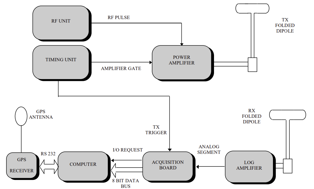
Fig.1: Glacio radar sketch.
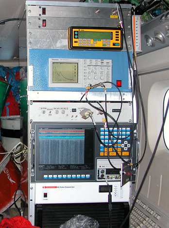
Fig.2: Glacio RADAR assembled on board.
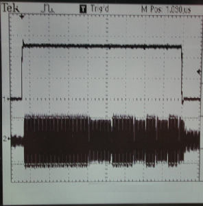
Fig.3:Phase coded radar pulse.
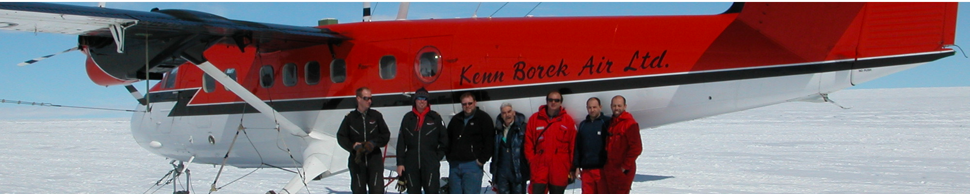
Since 1997, the Istituto Nazionale di Geofisica e Vulcanologia (INGV) in Italy has been involved in the development of the airborne RES system named Glacio RADAR, which is under continuous up gradation [1]. The Glacio RADAR was mounted on an aircraft DE HAVILLAND DHC-6 Twin Otter (fig. 2), that flies at an optimum altitude 1000 ft (around 300m) above the ice surface during the survey in Antarctic regions. During several Italian Antarctic Expeditions (1997, 1999, 2001 and 2003) a large amount of data was collected, with more than 60’000 km of flights (see maps) in the eastern part of Antarctica and around the Italian base Mario Zucchelli station and Italian-French base station Dome C fig. 2.
GLACIO RADAR SYSTEM: The Glacio RADAR model used during the 1997 and 2003 Italian Antarctic Expeditions (fig. 1), operates at 60 MHz with an envelope pulse width variable between 0.3 s and 1 s. The carrier generator was developed using a Phase Lock Loop (PLL) frequency synthesizer, which could synthesize frequencies from 40 MHz to 75 MHz with 1 kHz step. In this way it was possible to fine tune the carrier frequency to reduce the reflected power from the folded dipole antenna due to mismatch.
One wire folded dipole constitutes the antenna system which exploits the wing reflectors to increase the gain.
The 4 kW pulsed power amplifier allowed us to obtain an adequate amplitude echo signal at the input of the receiver. The receiver listening time was 51.2 µs in 1997 and 64 µs from 1999 and consequently the maximum penetration depth in the ice has been about 4.3 km in 1997 and 5.3 km from 1999 to analyze deepest zone in Antarctica.
The receiver consists of a low-noise logarithmic envelop detector with a dynamic range of 80 dB. The acquisition system uses high speed IC’s and flash converter. The received echo signal is digitized (8 bit) at the sampling frequency of 20 MHz with an error in the received echo time of about 50ns. The receiver sensibility is -100 dBm which is good enough to detect the signal that suffers a loss of about 160 dB mainly due to, surface scattering at the various interfaces, inhomogeneities in the ice volume, geometrical attenuation and absorption in the media etc. The transmitted pulse repetition rate (PRR) is 100 traces/second and to increase the signal to noise ratio, the average trace is calculated on every ten received traces. The horizontal resolution is 7 m/trace at a mean flight speed of 100 - 120 kt (185 - 220 kmh-1 ) . The vertical error is ± 4.2 m [1] which is compatible with 50 ns sampling time, while the range is covered by 1280 digitized samples per trace.
The acquisition software, for the acquisition board, has been developed in C language and allow an easy management of records and files. The software provides the acquisition of GPS data via the RS232 serial port so that each data file has its own header and tail which specify location (longitude, latitude, height) and time of survey.
The location of the radar traces was obtained by a global position system (GPS) Trimble 4000 SSE system (L1 and L2 frequency), with a geodetic antenna mounted on the fuselage, and synchronized to the radar acquisition. The precision in x, y coordinates used to geo-reference the radar data was ± 20 m (without pseudo-range differential correction ). All radar profiles were processed with a software package designed for the radio-echo sounder. Ice thickness was calculated using a constant electromagnetic wave propagation velocity of 168 m µs-1 [2]. The surface elevation was based on the European Remote sensing Satellite (ERS–1) radar altter data [3]. Bedrock elevation was calculated by subtracting the ice thickness from the surface elevation by ERS – 1.
This radar has been employed in several PNRA Italian Antarctic Expeditions (1997, 1999, 2001 and 2003) with continuous improvements in the electronics, signal acquisition and elaboration.
Two new enhanced Glacio RADARs have been designed and realized by INGV and will be used in the next campaigns exploiting new techniques in the real-time signal processing [4]. To increase the resolution and the general performances of the system, 180 degrees phase reversal code sub-impulse duration has been reduced (fig. 3). The working frequencies of the new phase coded radars are 150 MHz and 300 MHz allowing significant improvement in the antenna system. In fact, 4 folded dipoles for each antenna constitute two phased arrays with a gain of 18 dBi that includes the effect of wing reflectors.