

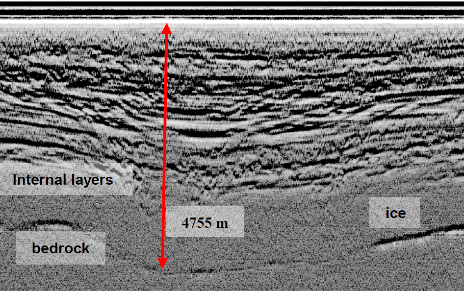
Fig.1: Deepest ice point in Antarctica
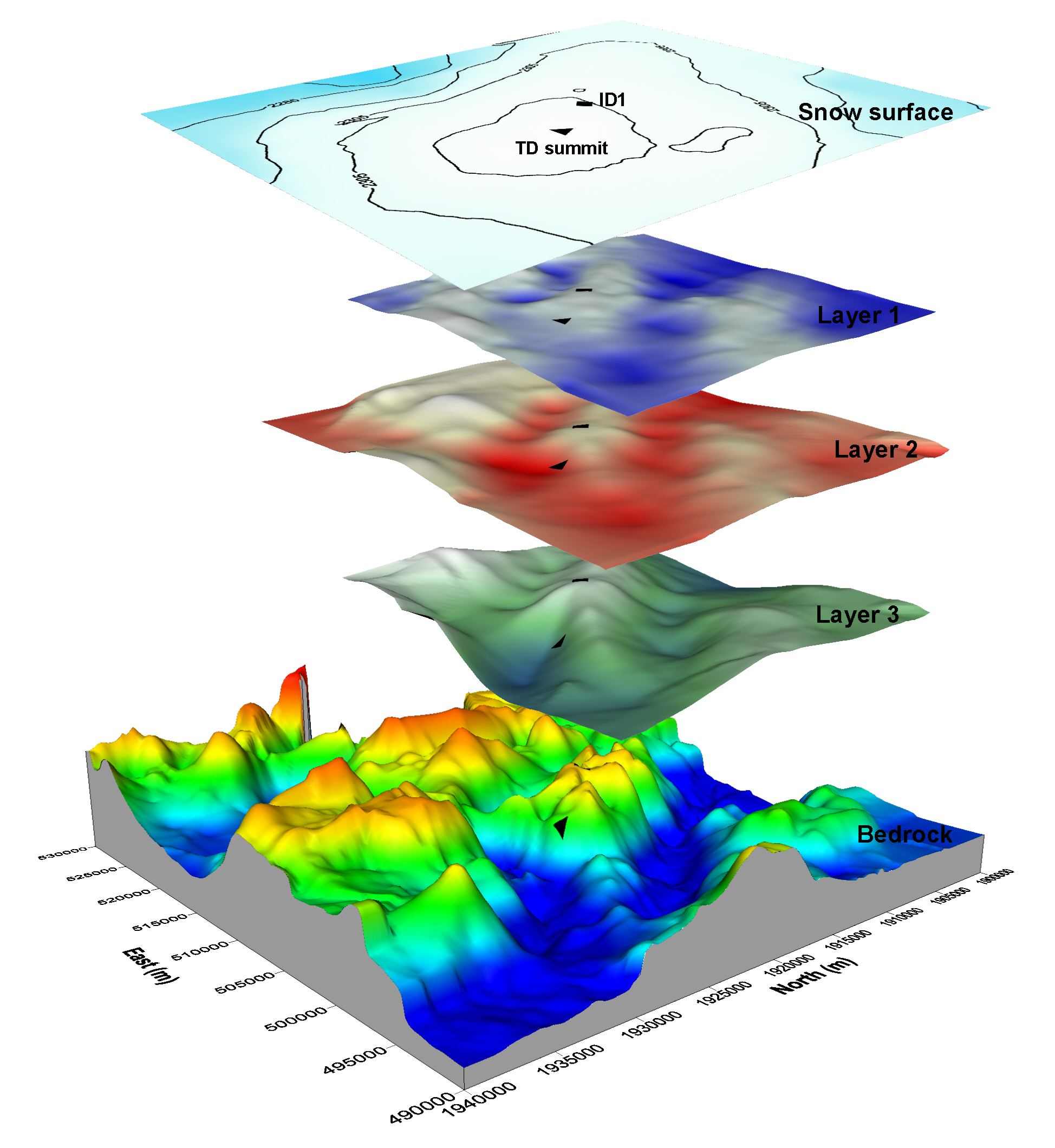
Fig.2: Talos dome ice layers and drilling point
Since the first use of a RES system in ice sheet surveys for ice thickness estimation, the measurements have been repeated and verified with other survey techniques such as seismic and gravity measurements. A RES system is able to obtain a reflection of the transmitted signal, or echo, from the ice surface and the ice-rock interface. By calculating the time difference between the two echoes, it is possible to estimate the thickness of the ice with a high degree of accuracy, knowing the propagation speed of the signal in the ice. The elevation of the rock substrate can then be obtained by adding the elevation of the ice surface (obtained from EARS1 radar satellite measurements and other available digital elevation models) to the ice thickness.
The measurement of ice thickness is the most widespread application of radar systems (Fig. 1). Most of these radar data have been collected, in different survey areas, by the National Science Foundation NSF of the USA, the Scott Polar Research Institute, UK (SPRI), the British Antarctic Survey, the Alfred Wegener Institute, Germany, the Technical University of Denmark (TUD) and, in recent years, the Italian Programma Nazionale di Ricerche in Antarctica (PNRA). RES measurements have been widely used to study the grounding line (the point at which continental ice, flowing towards the open sea, begins to float) of many Antarctic outlet glaciers. From the shape of this glacier outlet port, with the measurement of ice velocity, it is possible to estimate the flow, i.e. the amount of ice flowing into the sea per second. This estimate over all glaciers in an area of the ice sheet plays an important role in calculating the total mass balance of the Antarctic ice sheet, an important indicator of climate change.
Another important and indispensable application of RES measurements is the selection of the ice core drilling site. In recent years, ice core drilling in the thickest areas of the ice caps has enabled the reconstruction of about 1 million years of our planet's climate history (EPICA project at Concordia Station). From the ice cores, it is possible to analyse the air content trapped in ice from hundreds of thousands of years ago. This analysis has clearly revealed how human activities have increased the amount of greenhouse gases over the years and how this has influenced the recent climate. Accurate information from RES systems on the depth of the rock substrate, topography and internal layering behaviour is as important as surface topography and ice flow velocity in choosing the best drilling location (Fig. 2).
Many of these surveys have been organised by the Italian glaciology radar group in various measurement campaigns in Italy and Antarctica as part of different research projects.