


Italian data download
Files format
Here information on data files download:
Antarctic data files:
RES data processing was performed with the Geophysical Survey Systems (GSSI) Radan program, converting the radar acquisition binary files (bin file) into DZT files (GSSI binary format). After processing and picking of the radar traces to obtain the positions of the bedrock and internal stratifications (if presents), the lay files (a CSV Comma Separated Values GSSI file) were generated. At the lay file, the GPS positions, were added in the out file (CSV file similar to the lay file) using the gasgen.exe Window exe program. The program uses the time of each radar track, written in the bin file, to derive the GPS position and add it to the out file.
The downloaded FlightXX.zip file contains two folders inside the main folder:
GPS: with GPS files * .dat, * .pos, * .ssf, * .wpt,
Radar Legs: with several folders named with the flight waypoints. Inside the folder:
gasgen_xx.exe processing file used to generate out files from lay files with GPS positions
* .bin: original binary data file acquired by the radar
* .lay: CSV text file in GSSI Radan format with the results of the rock bottom "picking" and stratifications (if present)
* .log: gasgen processing log file for checking the positions entered in the out file
* .out: file similar to lay file but with GPS points positions added
* .dat: text file GPS GPS data
* .DZT: binary file with radar tracks in Radan GSSI format
* .mdb: Radan GSSI database file
and a file Mission X Flight X.dat containing the GPS coordinates of the radar traces surface point.
More informatione in info database.pdf (italian).
None of the IRES data can be used without accurate reference to:
Urbini S., Zirizzotti A., Bianchi C., Cafarella L., Baskaradas J., Sciacca U. (2023). IRES Italian Radio Echo Sounding. Istituto Nazionale di Geofisica e Vulcanologia (INGV). https://doi.org/10.13127/ires
Antartic fligth map
Italian fligths map
MAppa dei voli in Italia (working in progress)
Italian campaigns
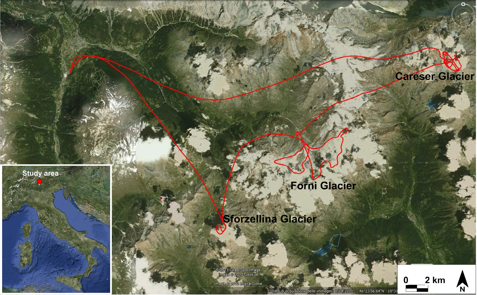 In the figure the path of the helicopter that allowed the simultaneous overflight of the three glaciers.
Sforzellina
Forni